


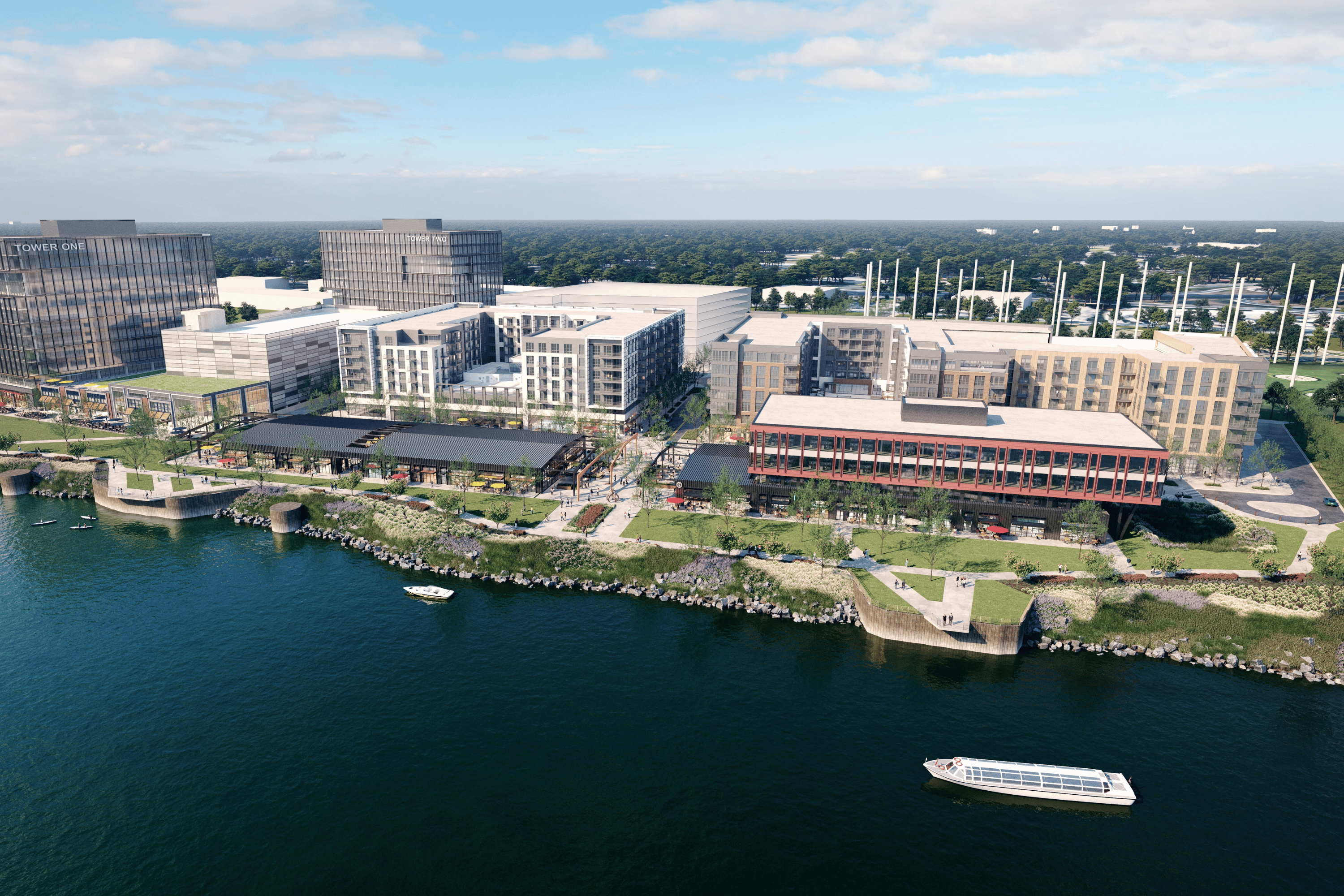
River North is a transformational, 104-acre urban waterfront district planned along more than one mile of the Cumberland River directly across from downtown Nashville. Envisioned as a complete mixed-use neighborhood, the master plan establishes a long-term framework for approximately 12 million square feet of residential, office, hospitality, civic, retail, and entertainment uses. It reimagines a historically industrial portion of the East Bank as a connected urban district centered on walkable streets, public spaces, multimodal transportation, and riverfront access.
At the master-planning level, River North required coordinating land use, density, transportation, infrastructure, open space, and the riverfront as one integrated system. An interconnected network of streets and urban blocks supports phased development while maintaining a consistent vision across future buildings, public spaces, and surrounding East Bank properties.
Connectivity is central to that vision. River North occupies a pivotal stretch between East Nashville and Germantown, communities long separated by the Cumberland River, interstate infrastructure, and dormant industrial land. The plan anticipates new vehicle connections across the interstate network and pedestrian and bicycle bridges across the river. Together with the district’s street and riverfront connections, these planned links would make River North a place where the two sides of Nashville meet, opening more direct routes between neighborhoods, jobs, public spaces, and the waterfront. Metro’s East Bank Vision Plan also identifies a proposed pedestrian and bicycle bridge at River North connecting to Germantown.
A strong public realm was central to the plan. The district framework incorporated parks, civic spaces, landscaped corridors, and gathering areas from the beginning. A coordinated streetscape system established walkable blocks, sidewalks, bicycle infrastructure, street trees, and connected routes for pedestrians, cyclists, transit users, and vehicles, creating a recognizable identity across individual parcels and phases. River North’s riverfront connections also contribute to the broader vision for a continuous East Bank greenway and a connected route around downtown.
To guide implementation, Metro Nashville adopted the River North Urban Design Overlay in 2018. The overlay translates the master plan into standards addressing the street network, building placement, frontage, height, massing, parking, landscaping, open space, and pedestrian experience. It provides enough structure to preserve the district’s connectivity and character while allowing individual properties to respond to changing development needs.
River North was the first major master-planned development to begin translating Nashville’s vision for the East Bank into an implementable framework. Before the East Bank became the focus of a broader citywide planning initiative, River North established a model for transforming underutilized industrial land into a dense, walkable, mixed-use neighborhood. Its approach to connectivity, development intensity, transportation, public space, and river access helped set an early direction for the East Bank’s continued evolution.
The plan also laid the groundwork for one of Tennessee’s most significant economic-development investments. Oracle later acquired approximately 60 acres within River North for a planned campus identified as its future world headquarters. Together, the master plan, Urban Design Overlay, and streetscape framework positioned River North as a catalyst for the East Bank’s transformation and a key link between communities once divided by the river and interstate.
Phase 1 Under Construction
Pursuing LEED ND
HASTINGS Architecture
Metro Nashville Planning


We're always looking to meet talented individuals. Visit our Careers page
